
Barakas:Géorgie (Europe).png

Takaran tilikan ngini: 766 × 600 piksal. Risulusi lain: 307 × 240 piksal | 613 × 480 piksal | 981 × 768 piksal | 1.280 × 1.002 piksal | 1.619 × 1.268 piksal.
Ukuran asli (1.619 × 1.268 piksel, ukuran barakas: 196 KB, tipe MIME: image/png)
.png)
| Pamaparan |
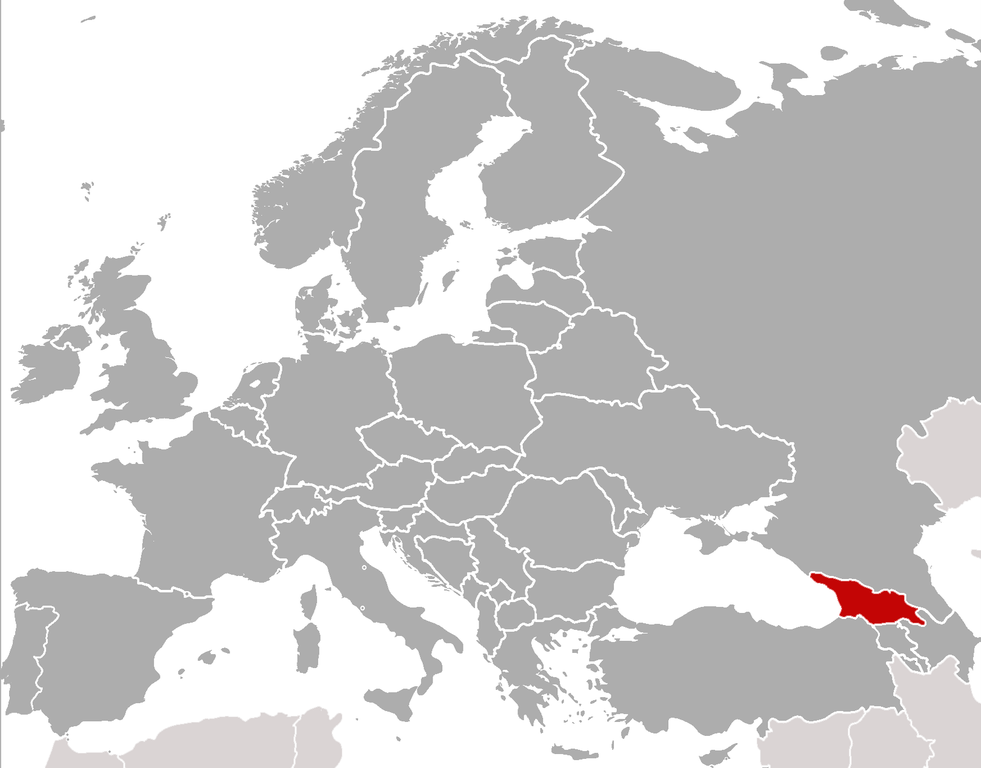
Location of Georgia (rep. in Europe) (Red) Location of Georgia.
(Grey) Europe. |
| Tanggal | (UTC) |
| Asal-mula | |
| Paulah |
|
| Ini merupakan gambar hasil penyuntingan yang berarti bahwa gambar tersebut telah diubah secara digital dari versi asli. Perubahan: cropped, added location. Versi asli dapat dilihat di sini: BlankMap-Europe-v4.png:
|
Ulun, nang ampunnya hak cipta matan karya ini, manaikakan barakas ini di bawah katantuan nangini:
| Barakas ngini dilisénsiakan lawan lisénsi Creative Commons Atribusi-BabagiSarupa 3.0 Kadada Adaptasi | ||
| ||
| Label lisensi ini ditambahkan pada berkas sebagai bagian dari pemutakhiran lisensi GFDL. |

|
Diijinakan gasan manyalin, manyabarakan wan/atawa mamodifikasi dokumén ngini di bawah syarat-syarat Lisénsi Dokuméntasi Bibas GNU, Vérsi 1.2 atawa labih hanyar nang ditarbitakan ulih Free Software Foundation; tanpa Bagian Invarian, tanpa Téks Sampul Muka, wan tanpa Téks Sampul Balakang. Salinan lisénsi dimasukakan ka bagian nang bajudul Lisénsi Dokuméntasi Bibas GNU. |
Pian kawa mamilih lisénsi pilihan Pian.
sarxan qaracoplu sarxan qaracoplu
Log pengunggahan asli
This image is a derivative work of the following images: sarxan qaracoplu*File:BlankMap-Europe-v4.png licensed with Cc-by-sa-3.0-migrated, GFDL
- 2010-02-23T18:00:48Z Maps & Lucy 2100x1525 (131745 Bytes) Fixed the border of Kosovo with Serbia, proportioned British Overseas Cyprus Territories, San Marino, Vatican City, Monacco, and the Spanish Overseas Moroccan Territories, and added Guersney, Jersy, Liechtenstein, and Gibralt
- 2009-03-30T16:12:12Z Cradel 2100x1525 (131867 Bytes) Reverted to version as of 17:12, 8 March 2009
- 2009-03-20T22:20:11Z Avala 2100x1525 (70412 Bytes) what does this map represent? upload an alternative for unofficial views
- 2009-03-08T17:12:32Z Cradel 2100x1525 (131867 Bytes) Reverted to version as of 06:05, 5 April 2008
- 2008-11-20T01:00:56Z Tocino 2100x1525 (70412 Bytes) Reverted to version as of 19:36, 19 March 2008
- 2008-04-05T06:05:34Z Hoshie 2100x1525 (131867 Bytes) added the UK SBAs on Cyprus
- 2008-03-22T21:58:25Z Nightstallion 2100x1525 (131807 Bytes) Reverted to version as of 16:35, 13 March 2008
- 2008-03-19T19:36:48Z Patstuart 2100x1525 (70412 Bytes) Reverted to version as of 18:16, 11 March 2008 - see [[Image talk:BlankMap-World-v6.png#As stated in reversion]]
- 2008-03-13T16:35:26Z Nightstallion 2100x1525 (131807 Bytes) upload a variant if you wish, but the majority in Europe recognises or will recognise.
- 2008-03-11T18:16:50Z Avala 2100x1525 (70412 Bytes) there is no consensus in Europe
- 2008-02-24T02:42:03Z Hoshie 2100x1525 (131807 Bytes) Added Kosovo since it has been internationally recognized
- 2007-05-02T09:05:00Z Roke 2100x1525 (70412 Bytes) better version derived from svg
- 2006-06-26T06:32:12Z Roke 748x546 (27077 Bytes) minor - bottom left box
- 2006-06-26T05:53:48Z Roke 748x546 (27099 Bytes) {{Information |Description= blank map of europe, including north africa and western asia. With french overseas territories shown in inset lower left (French Guiana, Guadeloupe, Martinique, Reunion) |Source= derived from [[:Im
Uploaded with derivativeFX
Riwayat barakas
Klik pada tanggal/waktu gasan manjanaki barakas ngini wayah itu.
| Tanggal/Waktu | Miniatur | Matra | Pamakai | Ulasan | |
|---|---|---|---|---|---|
| wayahini | 6 Pibuari 2011 06.21 | | 1.619 × 1.268 (196 KB) | ComtesseDeMingrelie | {{Information |Description=Location of Georgia (rep. in Europe) {{legend|#FF0000|'''(Red)''' Location of Georgia.}} {{legend|#808080|'''(Grey)''' Europe.}} |Source=*File:BlankMap-Europe-v4.png |Date=2011-02-05 22:20 (UTC) |Author=*[[: |
Tautan barakas
Tungkaran nangini mamakai barakas ngini:
Pamakaian barakas global
Wiki lain nangini mamakai barakas ngini:
- Pamakaian pada als.wikipedia.org
- Pamakaian pada ar.wikipedia.org
- Pamakaian pada bcl.wikipedia.org
- Pamakaian pada bo.wikipedia.org
- Pamakaian pada br.wikipedia.org
- Pamakaian pada bs.wikipedia.org
- Pamakaian pada incubator.wikimedia.org
- Template:Wn/az/Ölkə xəbərləri-Gürcüstan
- Wn/az/Ermənistanın Gürcüstandakı səfirliyi qarşısında etiraz aksiyası keçirilib
- Wn/az/Bakı-Tbilisi-Qars yeni dəmir yolu xəttində ilk sınaq keçirilib
- Wn/az/Gürcüstanın Cənubi Osetiya Muxtar Vilayətində Türkiyə jurnalistlərinə atəş açılıb
- Wn/az/Çəkiliş vaxtı Mixail Saakaşvilinin xanımına hücum ediblər
.png)