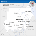
Barakas:Sudan - Location Map (2011) - SDN - UNOCHA.svg

Konten halaman tidak didukung dalam bahasa lain.
Tumatan Wikipidia Banjar, kindai pangatahuan

Ukuran asli(Barakas SVG, nominal 254 × 254 piksel, ganal barakas: 1,54 MB)

Barakas ngini asalnya tumatan Wikimedia Commons wan pinanya dipakai ulih rangka-gawi lain. Pamaparan matan laman panjalasannya ditampaiakan di bawah.

Ringkasan

Pamaparan
English: Locator map of Sudan.
Tanggal
Asal-mula
Paulah
Versi lainnya

[babak]

SVG genesis
InfoField
 
The SVG code is valid.
 
Gambar vektor ini dibuat menggunakan Inkscape.
 
 This map uses embedded text that can be easily translated using a text editor.


Lisénsi

w:id:Creative Commons
atribusi
Berkas ini berlisensi di bawah lisensi Creative Commons Atribusi 3.0 Tanpa Adaptasi
Atribusi: OCHA
Pian dibulihakan:
  • gasan babagi – gasan manyalin, mauarakan wan mamindahakan karya ngini
  • gasan manggubah – gasan mangadaptasi karya ngini
Bapandal katantuan nangini:
  • atribusi – Pian musti mancantumakan pangakuan nang rasuk, mambariakan tautan ka lisénsi, wan mamadahi amun ada paubahan. Pian kawa manggawinya sakahandak Pian, tagal kada maiihakan kalu pambari lisénsi mandukung Pian atawa pamakaian Pian.
This map is part of a collection of 216 free country maps, created by the UN Office for the Coordination of Humanitarian Affairs (OCHA), to be used in print, web or broadcast products.

The ReliefWeb Location Maps released here are maps that highlight a country, its capital, major populated places and the surrounding regions.

Attribution Requirements

Using the map without modifications: ensure that the sources and the disclaimer are below the map. Credit as follows: "Credit: OCHA".

For use with alteration: remove the OCHA logo and disclaimer following any modification to the map, but keep the data sources as mentioned below the map. Credit the modified map as follows: "Based on OCHA map". You are responsible for the content of your map.

We are keen to receive your feedback and hear how you used OCHA's maps. We would be grateful if you would notify us by e-mail and share your work with us.

UN Disclaimer
The designations employed and the presentation of material of this map do not imply the expression of any opinion whatsoever on the part of the Secretariat of the United Nations concerning the legal status of any country, territory, city or area or of its authorities or concerning the delimitation of its frontiers or boundaries.
VRT Wikimedia

Karya ini telah bebas dan dapat digunakan oleh siapapun untuk berbagai keperluan. Apabila Anda ingin menggunakan kembali konten ini, Anda tidak perlu meminta izin selama Anda mengikuti syarat-syarat lisensi yang tertera di halaman ini.

Wikimedia telah menerima surel yang mengonfirmasikan bahwa pemegang hak cipta telah menyetujui terbitan ini di bawah syarat-syarat yang tertera di halaman ini. Korespondensi ini telah ditinjau oleh anggota VRT dan disimpan dalam arsip perizinan. Korespondensi ini tersedia bagi sukarelawan tepercaya sebagai tiket #2014031410007248.

Apabila Anda memiliki pertanyaan mengenai arsip korespondensi ini, gunakan papan pengumuman VRT. Pranala tiket: https://ticket.wikimedia.org/otrs/index.pl?Action=AgentTicketZoom&TicketNumber=2014031410007248
Find other files from the same ticket: SDC query (SPARQL)

Captions

Add a one-line explanation of what this file represents

Items portrayed in this file

menggambarkan Indonesia

status hak cipta Indonesia

berhak cipta Indonesia

sejak Indonesia

2011

tipe media Indonesia

image/svg+xml

Riwayat barakas

Klik pada tanggal/waktu gasan manjanaki barakas ngini wayah itu.

Tanggal/WaktuMiniaturMatraPamakaiUlasan
wayahini20 Disimbir 2015 07.48Pratinjau gasan bantuk par 20 Disimbir 2015 07.48254 × 254 (1,54 MB)ChronusReverted to version as of 02:48, 2 February 2015 (UTC)
10 Pibuari 2015 15.28Pratinjau gasan bantuk par 10 Pibuari 2015 15.281.000 × 1.000 (1,99 MB)Nafsadhis there a reason for your revert Chronus?
2 Pibuari 2015 10.48Pratinjau gasan bantuk par 2 Pibuari 2015 10.48254 × 254 (1,54 MB)ChronusReverted to version as of 07:16, 30 December 2014
25 Januari 2015 20.41Pratinjau gasan bantuk par 25 Januari 2015 20.411.000 × 1.000 (1,99 MB)NafsadhThat version do not address area disputes properly
30 Disimbir 2014 15.16Pratinjau gasan bantuk par 30 Disimbir 2014 15.16254 × 254 (1,54 MB)ChronusReverted to version as of 03:37, 18 November 2014
10 Disimbir 2014 07.44Pratinjau gasan bantuk par 10 Disimbir 2014 07.441.000 × 1.000 (1,99 MB)NafsadhHala'ib Triangle and Bir Tawil name text
10 Disimbir 2014 07.37Pratinjau gasan bantuk par 10 Disimbir 2014 07.371.000 × 1.000 (1,98 MB)NafsadhConventional colors
18 Nupimbir 2014 11.37Pratinjau gasan bantuk par 18 Nupimbir 2014 11.37254 × 254 (1,54 MB)Pharostry without logo for now
8 Mai 2014 09.07Pratinjau gasan bantuk par 8 Mai 2014 09.07254 × 254 (1,2 MB)UN OCHA maps bot== {{int:filedesc}} == {{Information |description={{en|1=Locator map of Sudan.}} |date=2011 |source={{en|1=[http://reliefweb.int/map/sudan/sudan-location-map-2011 Sudan Locator Map (ReliefWeb)]}} |author={{en|1=[[w:en:United Nations Offi...

Tungkaran nangini mamakai barakas ngini:

Pamakaian barakas global

Wiki lain nangini mamakai barakas ngini:

Metadata